You can produce simple to complex static maps using QGIS. Below are some examples from QGIS’ map examples and screenshots.
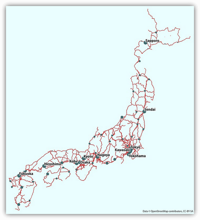
Railways of Japan using OpenStreetMap data
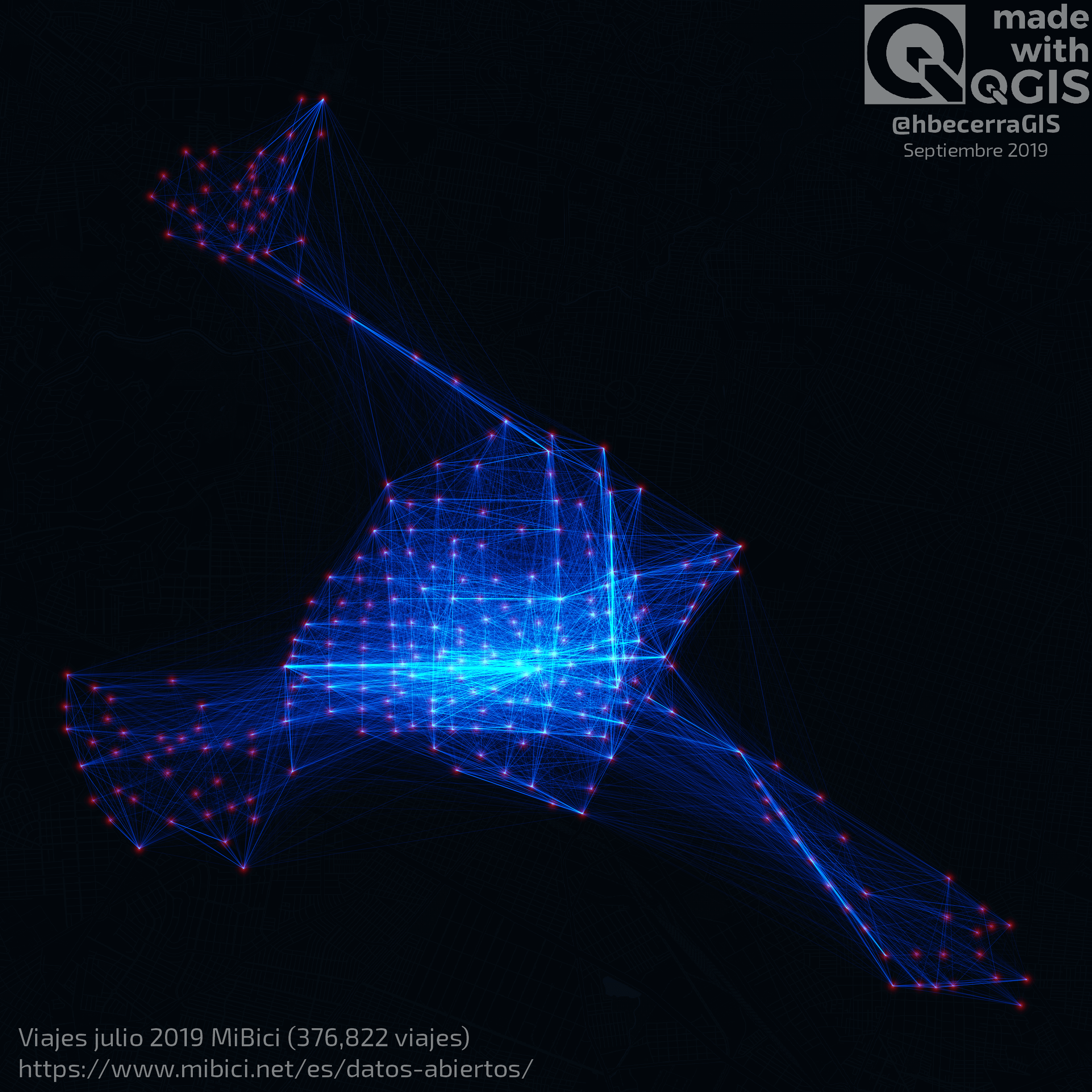
Frequency of MiBici trips in Guadalajara, Mexico
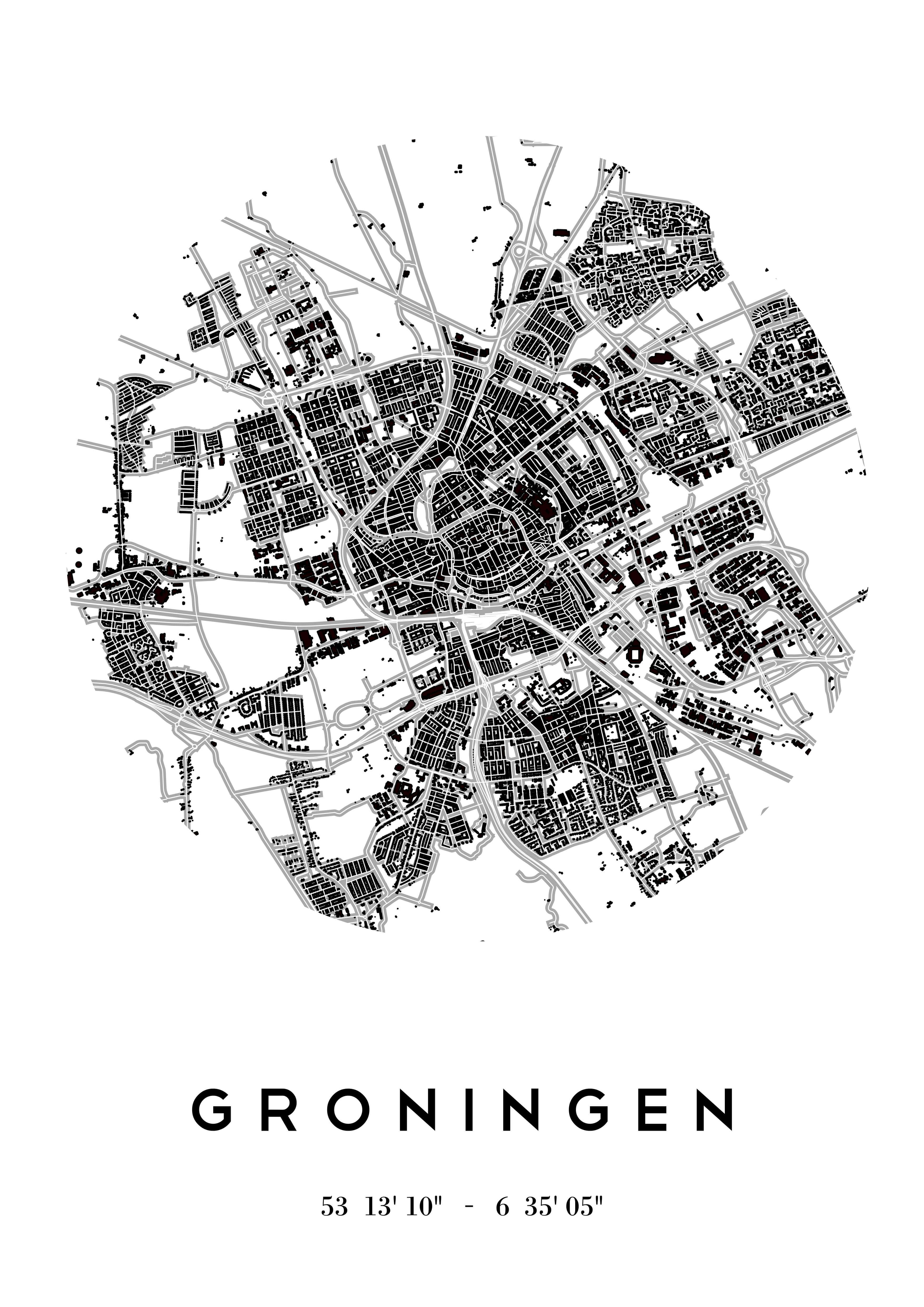
Northern Netherlands using Dutch open topography and road layers
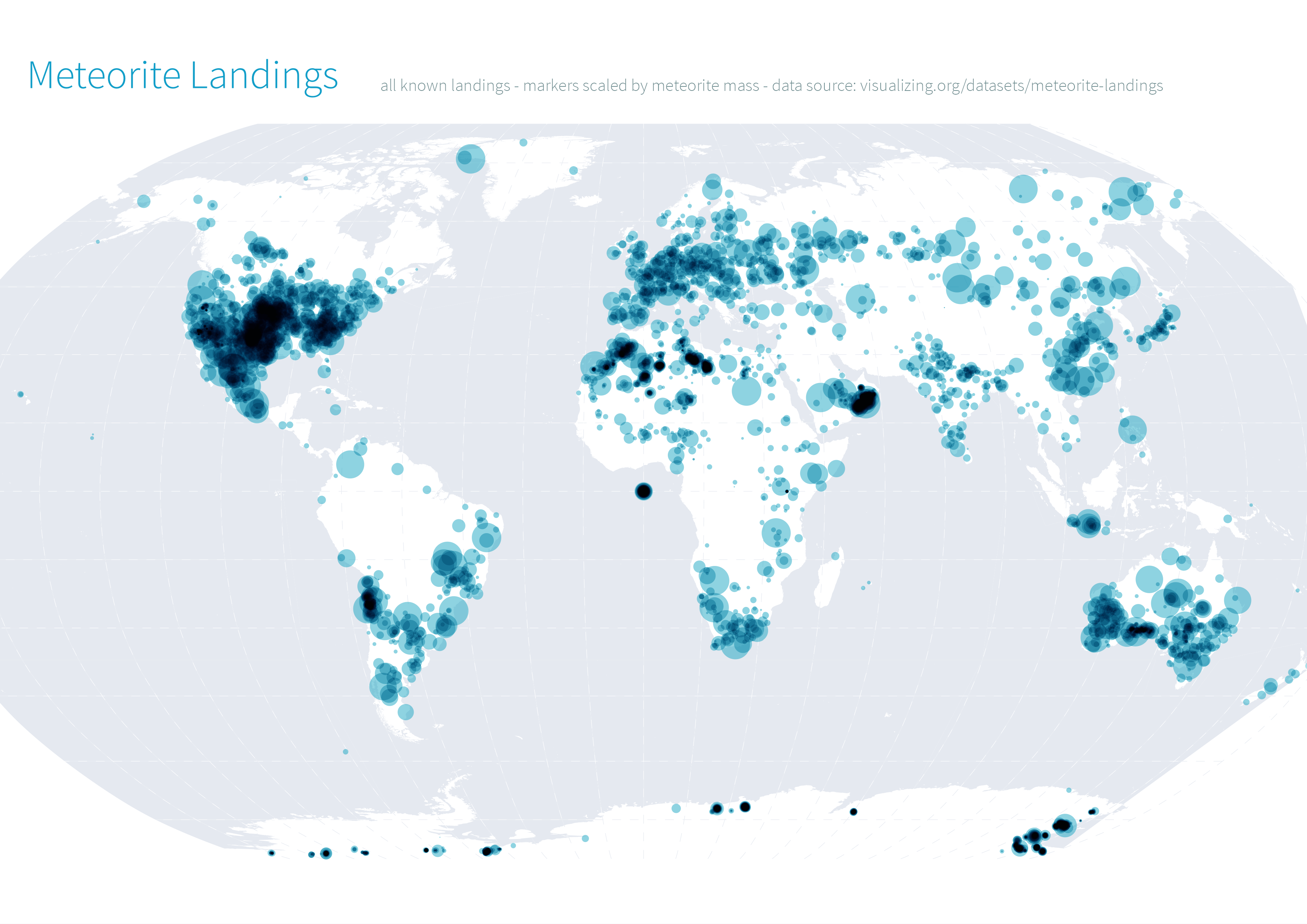
Global meteorite landings. Note data has not been cleaned
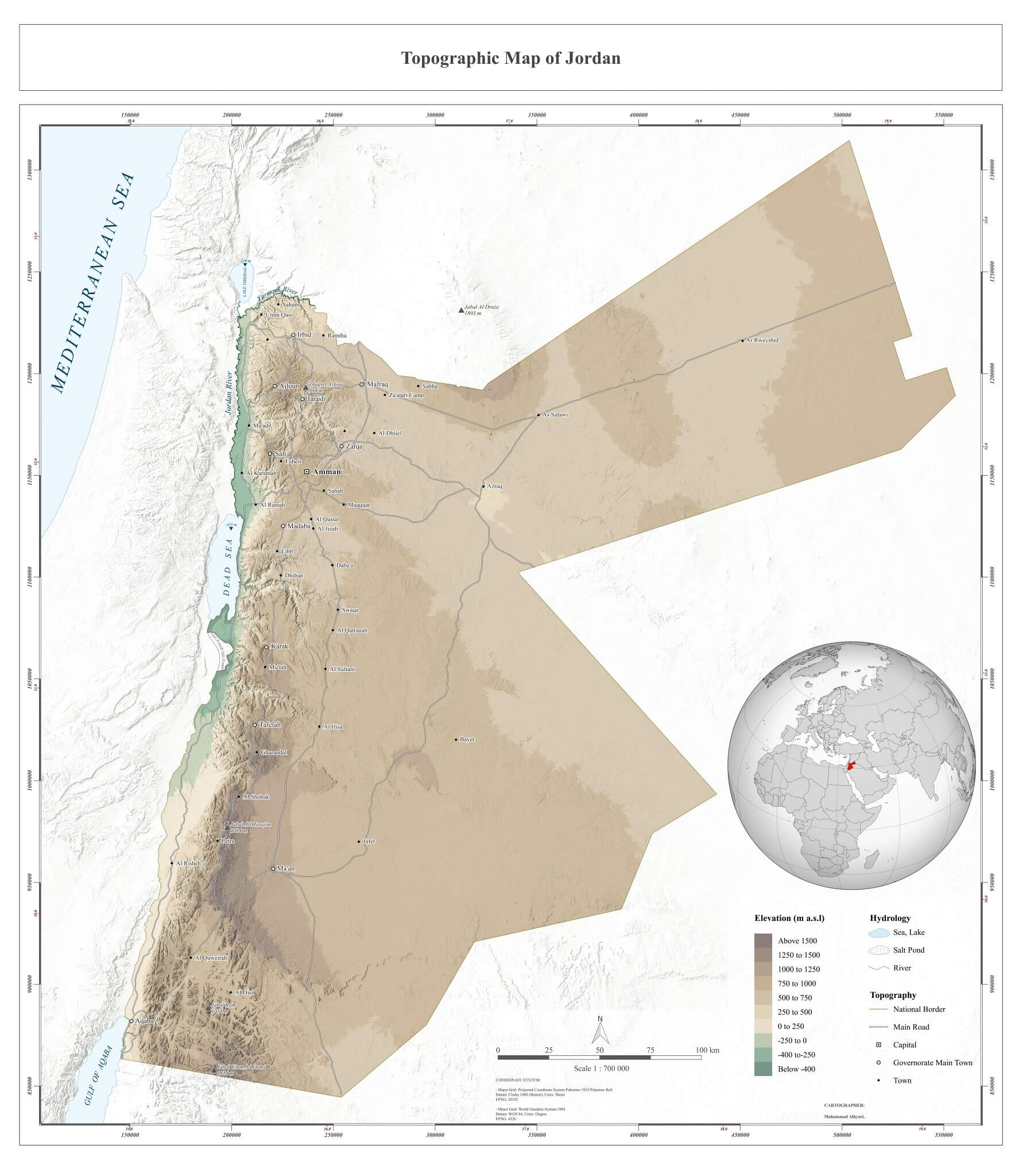
Topographic map of Jordan
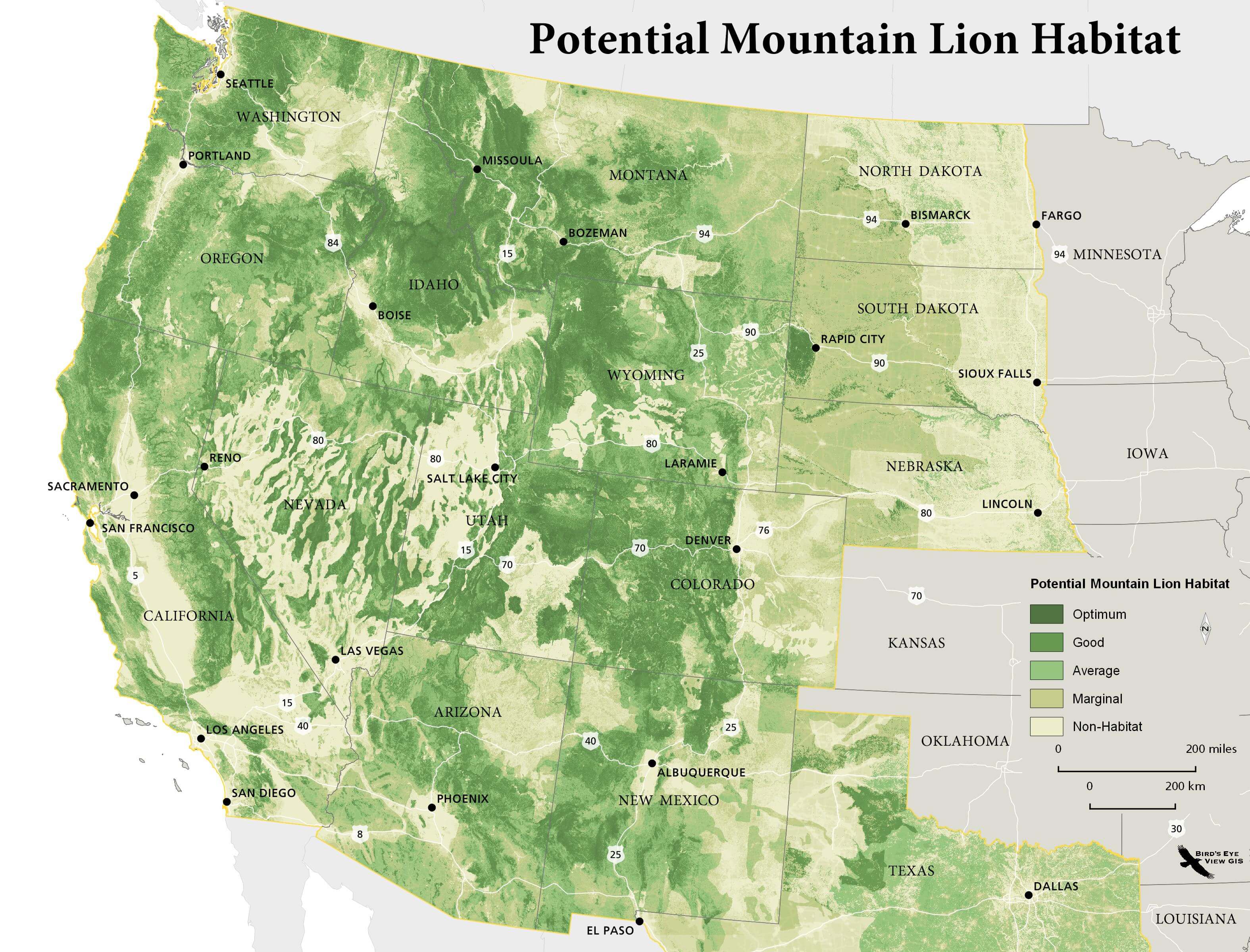
Potential mountain lion habitat using exisiting prey habitat and human footprint data
Previous submodule:
What's a GIS?
Next submodule:
Data Types and Formats